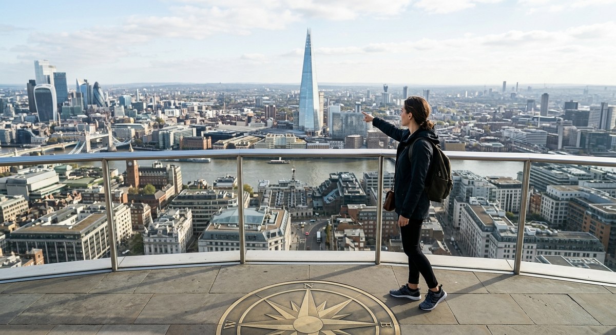
You step out of a subway station in a city you have never visited before. The street signs are in a language you do not read. Your phone battery is at 4%. Panic starts to set in. Then you look up. You spot a tall clock tower, notice the sun is low on your left shoulder, and realize the street numbers are climbing as you walk. Without a single digital map, you already know which way to go. That feeling of control is what this guide is about.
Navigating a city without GPS is easier than you think when you know what to look for. By training your eye to spot memorable landmarks and using simple directional cues like the sun’s position or street numbering patterns, you can build a mental map that never runs out of battery. This guide breaks down the core techniques so you can walk any city with confidence, whether you are exploring a new neighborhood or traveling abroad.
Why Landmarks and Directional Cues Work Better Than GPS
Most people rely on turn by turn directions from their phone. The problem is that digital navigation weakens your spatial memory. When you stare at a blue dot on a screen, you stop paying attention to the world around you. You arrive at your destination but could not retrace the route if you tried.
Learning to navigate using landmarks and directional cues does the opposite. It forces your brain to build a mental model of the city. Every tower, shadow, and street sign becomes part of a living map you carry in your head. That mental map grows stronger each time you use it. It does not disappear when your signal drops or your battery dies.
There is another benefit. When you navigate by sight and instinct, you notice more. You find hidden courtyards, interesting architecture, and local spots that never show up on a map. The journey becomes part of the experience instead of just a means to an end. For travelers and urban explorers, that shift in perspective is everything. If you want to build deeper skills, our guide on mastering urban navigation techniques without using a map is a great next step.
How to Build Your Mental Map in Three Steps
You do not need a special talent to navigate without digital tools. You just need a system. Follow these three steps every time you enter a new area.
-
Pick three landmarks at your starting point. Before you move, look around and choose three things that are permanent and visible. They could be a church spire, a distinctive building color, a bridge, or a statue. Memorize them. These become your anchor points. If you get lost, you can always return to one of them and reorient.
-
Note the direction of the sun or shadows. The sun rises in the east and sets in the west. In the Northern Hemisphere (most of the United States), the sun sits in the southern half of the sky. Use shadows to figure out cardinal directions. At midday, shadows point north. In the morning, shadows point west. In the afternoon, shadows point east. Once you know north, you know all four directions.
-
Use street numbering patterns as a compass. Many cities number streets in a logical order. In Manhattan, street numbers increase as you go north. In Chicago, Madison Street splits the city into north and south, with addresses climbing as you move away from it. Figure out the numbering system early, and you can estimate how far you are from any point. For more on this, check out our tips on developing natural wayfinding skills in urban environments.
Repeat those three steps at every major intersection. Within an hour, your mental map will feel solid.
What to Look for When You Scan a Cityscape
Your eyes are your best navigation tool, but you need to know what to look for. Use this checklist to scan your environment every time you change direction.
- Towers and tall structures. Church steeples, water towers, clock towers, and skyscrapers are visible from far away. They make excellent reference points because they rarely move or disappear.
- Unusual building colors or materials. A bright red brick building, a green glass tower, or a stone courthouse stands out in a sea of similar structures. Use them as checkpoints.
- Bridges and waterways. Rivers, canals, and large bridges act as natural boundaries. They help you understand the shape of the city and prevent you from walking in circles.
- Train tracks and elevated lines. Rail lines often cut through cities in straight lines. They can serve as orientation guides, especially in older industrial areas.
- Street sign shapes and colors. In the United States, highway signs are green, interstate signs are red and blue, and local street signs are usually white or green. Learning the visual language of signs helps you read the city faster.
- Park land and open spaces. Large parks break up the grid and give you a sense of scale. They also tend to have paths that lead to major streets.
Scanning is a habit. You can read more about training this habit in our article on mastering city navigation without maps using natural landmarks and spatial cues.
Techniques and Common Mistakes
Some methods work every time. Other approaches, while popular, can lead you astray. The table below compares techniques that help with mistakes that hurt.
| Effective Technique | Why It Works | Common Mistake | Why It Fails |
|---|---|---|---|
| Using the sun and shadows | Gives reliable cardinal directions any time of day | Relying on cloud cover or indoor spaces | Without sun, you lose orientation unless you have a backup cue |
| Memorizing three landmarks per zone | Creates mental anchor points that prevent getting lost | Choosing landmarks that move or change (food trucks, temporary signs) | A moving landmark disappears, leaving you with no reference |
| Following street numbering patterns | Tells you distance and direction without a map | Assuming every city uses a logical grid | Many cities have winding streets or no numbering system at all |
| Listening for traffic flow or water | Sounds carry direction; highway noise or river sounds indicate edges | Ignoring ambient noise or confusing similar sounds | Not all cities have distinct sound cues; loud environments can mask them |
| Reading architectural styles | Older buildings often cluster in certain neighborhoods | Judging distance by building height alone | A tall building can look close but be blocks away in a dense city |
Understanding these contrasts saves you from frustration. For a deeper look at how to read the urban environment, see our guide on learning to read urban architecture for effective wayfinding in cities.
Advice from Experienced Urban Explorers
People who navigate without GPS for a living or hobby have developed a set of habits worth borrowing. Here is what seasoned explorers say.
“The single most important skill is to stop and look behind you every few blocks. If you know what the street looks like from the opposite direction, you will never feel lost when you turn around to go back. Your brain stores both views as separate landmarks, giving you double the information.” — Maria K., urban explorer and author of City Senses
That advice is deceptively simple. Most people only look forward. By turning around occasionally, you build a 360 degree mental image of your route. You also notice details you would otherwise miss, like a mural on a garage door or a hidden alley.
Another trick from experienced navigators is to use the concept of “handedness.” If you walk with a river or train line on your left side, you always know which direction to turn to get back to it. Linear features like these act as a safety line. As long as you stay on one side of them, you cannot get completely turned around.
For more expert insights, check out our collection of strategies for urban wayfinding when technology fails.
How to Practice Without Pressure
You do not need to wait for a travel emergency to practice these skills. Start in your own neighborhood. The next time you walk to the grocery store or the train station, leave your phone in your pocket. Challenge yourself to navigate using only what you see.
Try these exercises:
- On a familiar route, identify at least five landmarks you have never noticed before. Write them down or say them out loud.
- Guess the cardinal direction of your destination before you start walking. Then check your guess against the sun or a compass.
- Walk to a place you know well, but take a different route. Use landmarks to guide you instead of your usual path.
- At a busy intersection, stop and describe the location to an imaginary person using only landmarks and directions. No street names allowed.
Each exercise builds your brain’s navigation muscle. Over time, you will find that you can walk into an unfamiliar area and immediately start picking up cues without thinking. That is the point where navigating using landmarks and directional cues becomes second nature. For structured practice, our article on boosting your city navigation skills without a GPS or map offers a full training plan.
What to Do When You Feel Lost
Even experienced navigators get turned around sometimes. The key is not to panic. When you feel disoriented, follow these steps.
First, stop walking. Standing still prevents you from making the situation worse. Take a breath and look around for any landmark you recognize, even a small one. It could be a distinctive awning or a unique street lamp.
Second, find the sun or a shadow. If you can determine east and west, you can reorient yourself. If the sun is hidden, look for moss on trees (it tends to grow on the north side in the Northern Hemisphere) or check which side of buildings has more weathering.
Third, walk to a linear feature. Head toward a river, a major road, or a train line. Linear features are hard to miss and easier to follow than point landmarks. Once you reach one, you can usually figure out where you are.
If all else fails, ask a local. But ask in a way that uses landmarks. Instead of “Where is Main Street?” try “Which direction is the clock tower from here?” Locals can point you to a visible reference faster than they can recall a street name. For more survival tactics, read our guide on what to do if your phone dies with 8 urban navigation skills to keep you safe in 2026.
The Senses That Most Travelers Ignore
Visual landmarks get most of the attention, but your other senses offer powerful navigation cues. Sound, smell, and even touch can tell you where you are.
Sound gives you distance and direction. The hum of a highway tells you where the city edge is. The clatter of a train station grows louder as you approach. In older cities, church bells ring on the hour and help you triangulate your position. In port cities, fog horns or boat horns mark the waterfront.
Smell is more subtle but surprisingly reliable. A bakery means a residential side street. Diesel exhaust points toward a bus depot or truck route. Saltwater or river mud tells you the water is near. In New Orleans, the distinct smell of beignets from Cafe du Monde can guide you toward Jackson Square.
Touch includes the ground beneath your feet. Cobblestone streets often indicate a historic district. Smooth asphalt with fresh crosswalk paint suggests a newer development. The slope of a street can tell you whether you are walking toward a river valley or away from it.
Learning to use these sensory layers makes city navigation richer and more reliable. For a full breakdown, see our article on developing your urban navigation skills using sound and scent cues.
A Practical Example: Navigating a Fictional City
Imagine you are standing at the corner of 5th and Pine in a city you have never visited. You want to reach the museum district, which you know is near the river. Here is how you would apply the system.
You scan and see a red brick church with a tall steeple two blocks north. You note the sun is behind you, which means you are facing east. That tells you the river, if it flows south, should be on your right if you walk east.
You notice that street numbers increase as you walk north. You are at 5th Street, and the museum district is near 12th Street. So you need to go north first, then east toward the river.
As you walk, you keep the steeple in view behind you. When you reach 12th Street, you turn east. You hear the low hum of a drawbridge, which confirms the river is close. You smell damp stone and green water. A few minutes later, you see the museum entrance.
You did not look at a phone once. You used a steeple, the sun, street numbering, sound, and smell. That is navigate using landmarks and directional cues in action. For more examples, read our guide on how to combine smartphone sensors and natural instincts for better city navigation.
Your First Step Toward Map-Free Travel
The world looks different when you stop following a blue dot and start reading the city itself. Walking becomes an act of attention. Every tower, shadow, and sound becomes useful information. You stop being a passive passenger in your own journey and start being an active navigator.
Start small. The next time you leave your house, pick one landmark and one directional cue. Use them to guide you. Repeat the process the next day with two landmarks. Within a week, you will notice how much richer your sense of place has become.
Navigating using landmarks and directional cues is not a party trick. It is a skill that gives you freedom. Freedom from battery anxiety. Freedom from spotty data. Freedom to explore with confidence, knowing that your own eyes and instincts can take you anywhere you need to go.