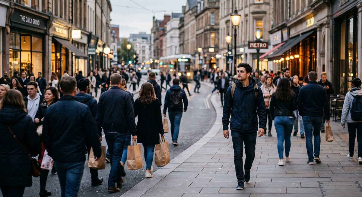
Imagine stepping off a subway car in a neighborhood you have never visited. Your phone battery just died. No GPS, no map, no data signal. Most people would feel a spike of panic. But look around. People are flowing in every direction. Some walk with purpose, others drift. That movement is a code. It tells you where the train station is, which blocks have shops, and where the quiet residential streets begin. Once you learn to read that code, you can navigate almost any city without a map.
Foot traffic is a real time navigation system. Crowds naturally cluster around transit hubs, commercial strips, and landmarks. By observing direction, density, and flow speed, you can identify the quickest routes, find exits, and locate key destinations. This guide teaches you how to read these signals and move through unfamiliar cities with confidence, no phone required.
Why foot traffic is your hidden compass
Cities are alive. People move in patterns that are not random. In the morning, streams of commuters flood toward central business districts. In the evening, that flow reverses. Shoppers gather on pedestrian friendly streets. Sidewalks near universities pulse with students at class change times. Even on a quiet Sunday morning, a trickle of dog walkers and joggers reveals the location of parks.
You already use these patterns without thinking. When you stand on a busy corner waiting for a friend, you notice which direction most people come from. That instinct can be sharpened into a reliable navigation tool. The key is understanding what different foot traffic signals mean.
How to read the crowd: the 4 signals
Use these four observable cues to orient yourself:
- Direction of flow. If a majority of people are walking in one direction, they are likely heading to a transit stop, a public square, or a major employer. Follow the flow to reach a hub. Walk against it to find quieter areas.
- Density of people. High density means a point of interest: a subway entrance, a market, a tourist attraction. Sparse sidewalks usually point to residential or industrial zones.
- Speed of movement. Fast walkers with backpacks or briefcases are commuters on a schedule. Slow strollers are shoppers, tourists, or locals at leisure. Fast traffic near a street corner often signals a bus stop or crosswalk.
- Group composition. Families with children point toward parks or schools. People in uniforms suggest a government building or hospital nearby. Couples with shopping bags indicate a retail district.
Watch for these signals from a fixed spot for two minutes. Then pick a direction and confirm your hypothesis with the next signal you see.
A step by step process to navigate using foot traffic
- Find an elevated spot. Stand on a street corner, a bridge, or outside a cafe with a good view. Do not move yet. Scan the pedestrian flow in all four directions. Notice which direction has the thickest stream.
- Identify the two main currents. Every city has at least one dominant traffic artery. Look for the street where the foot traffic is heaviest and most constant. That is usually a commercial corridor or the path to a transit hub.
- Walk along the heavy flow for 5 to 10 minutes. Do not turn. Stay with the crowd. You will likely reach a train station, a major intersection, or a plaza. Once there, take a mental snapshot of your surroundings.
- Turn around and walk against the crowd. This confirms your mental map. If you pass the same landmarks, you have learned the axis. Now you can branch off into less busy streets.
- Repeat the process in a perpendicular direction. Cross the heaviest flow at a 90 degree angle. This creates a mental grid. Most cities are gridded or have clear radial hubs. Once you know two major axes, you can triangulate your position.
Each time you repeat this cycle, your internal map becomes more detailed. After three cycles in a new district, you can usually estimate where you are relative to the main hub.
Common mistakes and fixes
Here are typical errors beginners make and how to correct them.
| Mistake | What happens | How to fix it |
|---|---|---|
| Following the largest crowd blindly | You end up in a dead end or a special event that disperses. | Always look for secondary flows to confirm you are on a permanent route. |
| Ignoring time of day | Morning commuter flow is strong but reverses in the evening. | Note the time. After 6 pm, follow the flow away from business districts. |
| Confusing tourist foot traffic with local traffic | Tourists cluster around museums and landmarks. | Watch for locals with grocery bags, dogs, or strollers. They use utilitarian routes. |
| Forgetting to look up | Signs, street names, and building numbers are overhead or on walls. | Combine foot traffic with visible signage. Glance up at every corner. |
| Over interpreting stillness | A quiet street might mean a holiday or a time of day. | Check for context. If nearby streets are busy, the quiet block is likely residential. |
Learn to avoid these pitfalls, and your ability to navigate city without map will improve rapidly. For additional training on reading the urban environment, consider this guide on how to read the urban environment to navigate without a map.
Expert advice from urban wayfinders
I once interviewed a retired mail carrier who had delivered in a 50 block radius of downtown Chicago for 30 years. He rarely used a map. When I asked how he managed on his first day, he said:
“I watched people. The most important thing is to find the main artery. In every city, there is a street where, at 8 am, everyone walks in one direction. That street connects everything. Learn that street and you learn the city. Then watch the people who are not in a hurry. They know the shortcuts.”
That advice applies everywhere. Whether you are in Boston, Seattle, or Miami, the collective movement of pedestrians is a map you can read instantly.
If you want to strengthen your ability to read these cues, the article on master urban navigation without maps using these essential skills offers targeted exercises.
Putting it all together in a new city
Let us walk through a real example. You land in San Francisco for a weekend trip. You have no data plan. You step out of the hotel on Market Street. Watch the crowd. Most people are walking toward the Embarcadero in the morning. That is the direction of the ferry building and BART stations. As you walk that way, you pass coffee shops and newsstands. The density increases. You hit the transit hub. Good. Now cross Market Street and walk perpendicular. The flow is thinner but steady. That path leads to the Financial District. By noon, the crowd reverses as people head to lunch spots. You can follow them to a cluster of restaurants. Without a map, you have found the heart of the city.
For deeper practice on combining multiple senses, the guide on develop your urban navigation skills using sound and scent cues shows how to layer auditory and olfactory clues on top of foot traffic signals.
Your turn to try it
Next time you visit any city, leave the map in your pocket for the first hour. Pick a starting point. Observe the flow. Follow the quietest pulse, then the loudest. Trust the crowd. It knows the way.
You will make a wrong turn now and then. That is fine. Each wrong turn teaches you a new pattern. Over time, you will build a mental atlas that does not rely on battery power or signal bars. The city becomes a living map, and you become a part of its flow.
If you want to take your skills further, read about how to enhance your urban navigation skills using environmental cues for additional techniques. Then go out and walk. The streets are waiting.