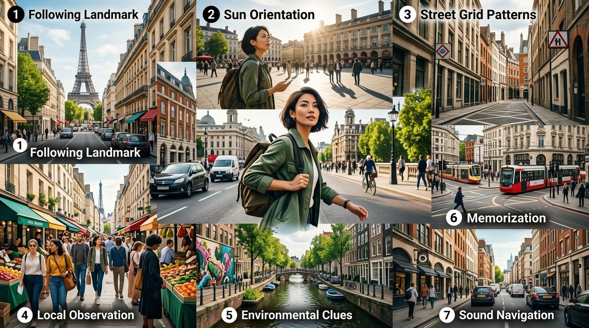
Your daily commute doesn’t have to be a dull routine. With the right urban navigation tricks, every trip across town becomes a mini adventure. Whether you walk, bike, or take transit, these techniques help you see your city in a new light. You start noticing details you once overlooked. You build confidence in your sense of direction. And you arrive at your destination feeling more alive than when you left. The best part? You don’t need a new app or fancy gear. Just a shift in how you pay attention.
Seven practical urban navigation tricks can reshape your daily commute into a playful exploration. By reading natural landmarks, interpreting street grids, listening to city sounds, following foot traffic, using shadows, building mental maps, and turning directions into spatial knowledge, you will navigate with less reliance on GPS and more connection to your environment. These methods work for any US city and any mode of travel.
Why Your Commute Is the Perfect Training Ground
Think about your most familiar route. You probably know it by heart. But how well do you really know it? If someone asked you to describe the third building on the left after the second traffic light, could you? Most people cannot. That is because we navigate on autopilot. We let the phone do the thinking.
The problem is that autopilot kills adventure. It also weakens your natural wayfinding skills. The good news is that you can retrain your brain during the trips you already take. Every commute is a chance to practice urban navigation tricks. The stakes are low, the environment is familiar, and you can experiment with zero consequences.
For instance, try walking a new block on the way to the subway. Notice how the architecture changes. Pay attention to where the sun hits the sidewalk. These small shifts build a richer mental map of your city. Over time, you will feel less like a passenger and more like a local explorer.
Trick #1: Use Natural Landmarks as Your Compass
GPS coordinates are helpful, but they do not teach you orientation. The sky, the sun, and the horizon are always there. In most US cities, streets run roughly north-south and east-west. If you know the time of day, you can estimate which direction you are facing. Morning sun in the east, afternoon sun in the south (in the northern hemisphere), and evening sun in the west.
Even on cloudy days, you can read the light. Shadows point north in the afternoon. That knowledge alone can prevent you from walking in circles. It is one of the oldest urban navigation tricks, and it works anywhere.
To get better, practice this: every time you step outside, pause and guess north. Then check your phone compass. Within a week, your accuracy will improve. You are essentially training your internal compass. For deeper guidance, check out master urban navigation techniques without using a map for more exercises.
Trick #2: Read the City Grid Like a Pro
Most American cities follow a grid pattern. Even irregular cities like Boston or San Francisco have underlying logic. Learn the naming conventions. In many towns, streets run one way and avenues another. Numbered streets usually increase as you move away from a central point. Odd and even addresses indicate sides of the street.
Once you understand the grid, you can navigate without a map. You can estimate distances by counting blocks. A typical city block is about 1/10 of a mile, but that varies. In Manhattan, 20 blocks equals a mile. In Portland, 12 blocks. Learn the block size in your neighborhood and you will never need to guess travel time again.
A common mistake is assuming every grid is perfect. That is where the real adventure begins. When streets diverge from the grid, notice why. A river, a hill, a historic district. Those anomalies become memorable landmarks. They are the cracks in the concrete that give a city its character.
Trick #3: Follow the Crowds (and the Silence)
Urban environments pulse with human traffic. Certain times of day, crowds flow toward transit hubs, business districts, or entertainment zones. By observing the direction of foot traffic, you can deduce where major destinations are. If you are lost, walking against the morning flow might lead you to a residential area. Walking with it leads to downtown.
But do not only follow the noise. Silence can be just as informative. A sudden quiet block often signals a dead end, a park, or a less traveled residential street. In many US cities, quiet streets parallel to loud avenues offer shortcuts. They also reveal hidden gems: a small cafe, a community garden, a mural.
To practice, try this: on your next commute, close your eyes for a few seconds (safely, of course) and listen. Can you tell if you are near a bus stop, a school, or a construction site? For a fuller breakdown of how sound and sight work together, see how to navigate urban jungles using sound and sight cues.
Trick #4: Listen to the Urban Soundscape
Cities have distinct sound signatures. The hum of an elevated train sounds different from a subway grating. The buzz of a commercial corridor differs from the quiet of a residential street. Sirens often follow main arteries. Birds sing in parks and tree-lined streets.
You can use these sounds to orient yourself without looking at a screen. For example, if you hear the rattle of a train and you know the nearest line runs north-south, you instantly know your orientation. Similarly, the echo between tall buildings tells you about street width. Wide streets with tall buildings produce a cavernous reverb. Narrow alleys deaden sound.
This trick works especially well when you are walking or biking, where you can hear clearly. It is also a fun way to engage your senses. Over time, your ears will become as reliable as your eyes for navigation. For a deeper practice, read develop your urban navigation skills using sound and scent cues.
Trick #5: Use Shadows and Light to Stay Oriented
Shadows are not just for photographers. They reveal the sun’s position and, by extension, cardinal directions. In the afternoon, shadows point east or northeast depending on the season. In the morning, they point west. If you are walking down a street and your shadow is to your left, you know the sun is on your right. That tells you roughly which direction you are heading.
Tall buildings create large shadow patterns that shift throughout the day. You can use these as landmarks. The shadow of a skyscraper at 3 PM is a reliable reference if you know the building’s orientation. This is especially useful in dense downtowns where you cannot see the horizon.
A tip: practice this at a fixed time each day. Notice how the shadows change with the seasons. In January, the sun is low and shadows are long. In July, they become short and sharp. Over a year, you will develop an intuitive sense of time and direction. For a dedicated guide, see how to use urban shadows and light to find your way in any city.
Trick #6: Learn One Street, Then Branch Out
Many people try to memorize a whole city at once. That is overwhelming. Instead, pick one main street in your neighborhood and learn it thoroughly. Walk its entire length. Note every cross street, landmark, business, and change in pavement. Once you know that spine, you can use it as a reference for everything else.
For example, if you know that Main Street runs north-south and you are on a parallel street, you can always estimate how far you are from Main. Intersections become predictable. You will start to notice that streets running east-west often have different character than north-south ones.
This trick scales. After you master one street, add another perpendicular to it. Soon you have a mental grid. Then you can explore diagonals, alleys, and cut-throughs. This is how locals navigate without maps. They have a mental skeleton of their city. For more on building that skeleton, read top tips for developing natural wayfinding skills in urban environments.
Trick #7: Turn Turn-by-Turn into a Mental Map
This is the trick that ties everything together. Instead of following step-by-step directions, transform them into a sequence of landmarks and directions. When your phone says “turn left in 200 feet,” look ahead and identify what you will see at that turn. A red awning. A fire hydrant. A specific tree. Then commit that to memory.
Over time, you will be able to reconstruct the route from memory alone. This is called building a cognitive map. It is the difference between being a passenger and being a pilot. You can practice this by replaying your commute in your mind before you go to sleep. Visualize each turn and the landmarks you saw.
A powerful exercise: once a week, turn off your phone navigation entirely. Use only what you have learned from previous trips. Yes, you might make a wrong turn. That is part of the adventure. Each wrong turn teaches you something about the layout. For a step-by-step method, see how to train your brain for better urban spatial awareness.
Common Mistakes and How to Avoid Them
Even experienced navigators slip up. Here is a table of common errors and the corresponding correction.
| Common Mistake | Why It Happens | Better Approach |
|---|---|---|
| Checking phone at every intersection | Loss of spatial memory | Glance at a landmark instead; build mental snapshots |
| Ignoring the sun | Overreliance on digital tools | Make a habit of noting sun position at the start of a trip |
| Treating all grids as perfect | Cities have irregularities | Expect deviations; use them as memorable clues |
| Walking while staring at screen | Misses environmental cues | Keep phone in pocket; use only for occasional confirmation |
| Forgetting to look behind you | Lacks reverse perspective | Turn around at intervals to memorize the return view |
A Step-by-Step Plan to Master Urban Navigation Tricks
- Pick one route you travel at least three times a week.
- Turn off GPS for the first half of the trip. Navigate using only the sun, shadows, and landmarks.
- Identify three landmarks per block. Write them down or photograph them.
- Trace the route in reverse on a weekend. Walk it backward and notice how the landmarks change perspective.
- Add a sensory layer. On the next trip, close your eyes for a moment and identify sounds that mark each segment.
- Test yourself. Describe the route to a friend without using street names. Use only landmarks and directions.
- Repeat with a new route. Expand to another part of your city.
This plan builds competence in about two weeks. By the end, you will feel a stronger connection to your city and a newfound confidence in your navigation ability.
What Expert Navigators Know
“The best navigators do not see a city as a collection of addresses. They see it as a living network of stories, light, and motion. The moment you stop asking ‘which way is north’ and start feeling the rhythm of the streets, you become part of the city instead of a visitor.”
– Carla M., urban geographer and wayfinding instructor
That quote sums up the philosophy behind these urban navigation tricks. It is not about memorizing every street. It is about tuning into the urban environment with all your senses. When you do that, even a trip to the grocery store becomes a small adventure.
Additional Skills to Practice
- What your city’s architecture tells you about navigating it without a map
- 5 street patterns that help you navigate any city without a map
- 7 urban navigation hacks to explore any city like a local in 2026
- How to use environmental cues for accurate urban wayfinding in 2026
Make Every Trip an Urban Adventure
You already have everything you need. Your eyes, ears, sense of direction, and curiosity. The seven urban navigation tricks here are just a starting point. The real magic happens when you make them a habit. Start with one trick tomorrow morning. Notice the sun. Listen to the city. Look for shadows. Turn a corner you have never taken.
Your commute will never be the same. You will arrive at work feeling awake, not drained. You will know your city in a way that no map app can teach. And you will have fun doing it. That is what urban navigation is all about: turning the ordinary into an adventure, one block at a time.