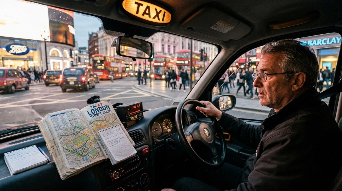
Picture a veteran cabbie in New York City gliding through midtown traffic, weaving from 42nd Street over to the West Side Highway, then cutting across town to a hidden address in the Village. No phone mount. No voice telling him to turn left in 500 feet. He just knew. That kind of mastery didn’t happen by accident. For decades, professional drivers built incredibly detailed mental maps of their cities, relying on memory, pattern recognition, and a few clever tricks. Understanding how did taxi drivers navigate before GPS opens a window into a lost art of wayfinding, one that modern urban explorers can still use today to move through cities with confidence.
Before GPS, taxi drivers mastered cities through mental maps built from repeated driving, memorizing street grids, landmark associations, and traffic patterns. They used paper maps like the Thomas Guide for planning, but relied on spatial memory for real time decisions. These same techniques can sharpen any urban explorer’s sense of direction and reduce dependence on smartphone navigation.
The Inner Map: How Cab Drivers Built a Mental Atlas
Taxi drivers did not just memorize street names. They constructed a full three dimensional model of their city in their heads. In places like New York, London, or Chicago, a driver could picture not only which blocks connected but also which alleys saved time, which intersections jammed at rush hour, and which shortcuts worked only on Sundays. This mental atlas was constantly updated through experience.
The process started with a big picture view. New drivers learned the major arteries, the highways, and the boundaries of neighborhoods. They memorized the grid system where one existed, like Manhattan’s numbered streets and avenues. Then they layered in details: one way streets, dead ends, construction zones, and landmarks that stood out. A driver might think “the brownstone with the green awning two blocks past the fire station” rather than a numeric address.
Studies on London taxi drivers, who must pass the famously difficult “Knowledge of London” test, show that the hippocampus actually grows larger as they learn the city layout. The brain physically changes to hold more spatial information. That is the power of deliberate navigation practice. For those interested in strengthening their own spatial memory, we recommend reading about how to train your brain for better urban spatial awareness.
The Knowledge: London’s Legendary Memory Test
London’s black cab requirement is the most extreme example of pre GPS navigation skill. To earn a license, drivers must memorize 25,000 streets and 20,000 landmarks within a six mile radius of Charing Cross. They spend two to four years learning “The Knowledge,” often using mopeds to physically ride the routes while reciting street names. The goal is to be able to plan the most direct route between any two points instantly, without a map.
Why did taxi drivers navigate before GPS? In London because the city has no grid. Streets twist, change names, and dead end unexpectedly. The only reliable way was total memorization. When the test finally became optional for minicabs, traditional black cabs kept it as a mark of pride. Even today, new drivers still learn The Knowledge before getting behind the wheel.
Practical Techniques Used by Professional Drivers
The daily methods of cab drivers boiled down to a repeatable system. Here is a step by step breakdown of how they managed without GPS.
-
Study the grid before driving. Drivers spent time with paper maps at home, tracing routes and memorizing the order of streets. They looked for patterns: in Washington D.C., lettered streets run east west and numbered streets run north south. In Chicago, major streets are spaced roughly every half mile.
-
Anchor with landmarks. Every driver had a set of primary landmarks: hospitals, tall buildings, parks, stadiums, fire stations. These served as mental waypoints. If you knew that the hospital was on 5th and Main, you could navigate from any direction to that point and then continue.
-
Learn one way street patterns. In dense downtown areas, one way streets are the backbone of efficient driving. Drivers memorized them like a chess player memorizes opening moves. They knew that on weekdays certain streets reversed direction for morning and evening rush.
-
Use visual cues from buildings and signs. Street signs weren’t always visible at night or in rain. Drivers watched for storefront names that matched street names (like a hardware store on Hardware Street) or identified a district by the architecture style. For a deeper look at reading building clues, see learn to read urban architecture for effective wayfinding.
-
Check the sun and shadows. On clear days, even a smoggy city sky gave directional hints. Drivers in Manhattan knew that the sun set roughly in the west over New Jersey. That helped them keep cardinal directions straight when streets curved.
-
Ask other drivers. Taxi ranks and cab stands were information exchanges. Drivers shared shortcuts, traffic alerts, and street closures. This real time human network was faster than any radio update.
Common Mistakes New Drivers Made (And How to Avoid Them)
Learning to navigate without GPS came with a learning curve. Even experienced drivers made errors. The table below shows typical mistakes and what veterans did instead.
| Technique | Common Mistake | Expert Fix |
|---|---|---|
| Mental map building | Relying on only major avenues | Also memorize secondary streets that parallel them |
| Landmark use | Picking landmarks that look the same (generic gas stations) | Choose unique spots: unusual architecture, statues, corner stores with signs |
| One way street memory | Confusing direction during evening rush | Focus on time specific patterns (e.g., 5th Ave southbound only 7 9 AM) |
| Sun orientation | Forgetting to account for daylight saving time | Use sun position relative to street names, not absolute time |
| Paper map reading | Opening map at every stop; losing context | Study the map before driving; only glance at it when turning |
These corrections saved minutes per trip, which added up to serious money over a shift. For urban explorers, the lesson is that building a mental map requires deliberate effort and revision. Boost your city navigation skills without a GPS or map with similar practice.
Tools of the Trade: Paper Maps and Foldout Guides
Before GPS, paper maps were a cab’s primary external reference. In New York, drivers kept a folded “T” map in the glove box. In Los Angeles, the Thomas Guide spiral bound atlas was indispensable because LA’s streets sprawl over 500 square miles. A driver could flip to the correct page grid (like “page 634, grid E4”) and find a street quickly.
But maps were used mainly for planning, not for turn by turn navigation. A veteran cabbie would glance at the atlas before starting a fare, trace the route with a finger, then close it and drive from memory. If lost, they pulled over to check, never while moving. That habit kept them safe and efficient.
Some drivers also carried small spiral notebooks with handwritten shortcuts, favorite restaurants for breaks, and notes about construction zones. These personal guides were updated weekly. The human touch made the difference.
Urban Explorer Takeaways: Applying These Skills Today
So how can you, as a modern urban explorer, use the same methods that taxi drivers relied on for decades? Start by treating your own city like a cab driver would. Here are concrete actions:
- Build a mental map by walking or biking new neighborhoods without using GPS. Try to recall the sequence of streets afterward.
- Pick three distinct landmarks per district and memorize their locations relative to each other.
- Learn the grid system of your city. Is it numbered? Alphabetical? Named after trees? Understanding the logic makes navigation intuitive.
- Practice shadow and sun reading on a sunny afternoon. Notice how shadows shift and what that tells you about direction.
- Ask locals for directions instead of pulling out your phone. That strengthens your verbal spatial memory.
For a full set of exercises, check out master urban navigation techniques without using a map. You can also learn how to navigate American cities using natural landmarks and local cues for a deeper dive.
“The biggest lesson I learned in thirty years driving a cab is that your brain is the best GPS you will ever own. You just have to feed it the right maps.”
Retired Chicago taxi driver, Frank Moretti, in a 2019 oral history interview
How Did Taxi Drivers Navigate Before GPS? Lessons for 2026
Even in a world of Google Maps and Waze, the old ways matter. When your phone battery dies at night in an unfamiliar part of town, or when a detour sends you into a maze of side streets, the skills that cab drivers used for generations can save you. You do not need to memorize 25,000 streets. But you can adopt their mindset: build a mental map, use landmarks, learn from others, and stay curious about the layout of the places you move through.
Start small. This week, leave your phone in your pocket during a short errand. Pay attention to which way you turn. Notice a building that stands out. By the end of the week, you will feel more connected to your city, and a little less dependent on the glowing screen. That is the real lesson from the pre GPS era: navigation is a skill you can sharpen, not a service you rent.