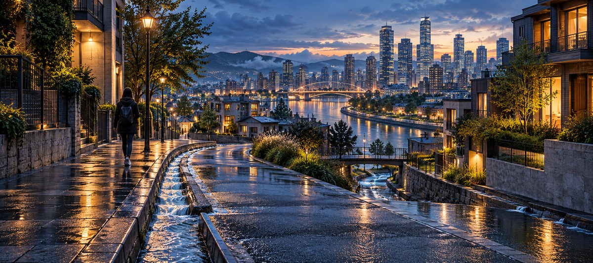
Your city is full of hidden signs that most people walk past every day. The way water moves through streets, the placement of fire hydrants, the slope of a gutter, even the direction a storm drain points. These features are part of a massive, hidden network that shapes every block you walk. In 2026, as cities across the United States upgrade their water systems to handle climate challenges, these water infrastructure elements have become even more readable. They can guide you home without a single glance at your phone.
By 2026, urban water infrastructure has evolved into a network of visible clues that any pedestrian can read. Stormwater channels, pipe markings, drainage gradients, and even the age of water meters reveal direction, neighborhood boundaries, and the natural slope of the land. Learning to spot these cues turns a simple walk into an orienteering exercise using the city’s own plumbing as your guide.
Reading Water Infrastructure as a Navigation Tool
Most people think of water systems as something buried underground, out of sight and out of mind. But the truth is that water infrastructure leaves a visible trail above ground. In 2026, many U.S. cities have added surface-level markers, colored curb paints, and directional arrows on storm drains as part of federal resilience programs. These additions make it easier for anyone to read the flow of water and, by extension, the layout of the city.
Here are the key elements to look for:
- Storm drain grates with directional arrows
- Colored fire hydrant tops indicating water pressure zones
- Curb cuts and gutter slopes that show downhill direction
- Green infrastructure features like rain gardens and bioswales
- Water meter boxes with street names or quadrant markings
- Pressure reducing valve stations at neighborhood boundaries
Each of these features tells a story about the land beneath your feet. Water always flows downhill, so following the path of stormwater runoff is a reliable way to find lower ground, major waterways, or the historic center of a city. Many older U.S. cities were built along rivers and creeks that have since been buried or channeled underground. The water infrastructure still follows those ancient paths.
How to Use Water Flows for Navigation in 2026
You can train yourself to notice these cues in just a few walks around your neighborhood. The process is straightforward and works in any city with modern water infrastructure.
-
Start at a known high point. Look for a fire hydrant with a colored top. In many cities, blue tops indicate high pressure zones (often uphill), while yellow or green tops signal lower pressure areas downhill. Walk downhill from a blue hydrant and you will eventually cross into a different pressure zone.
-
Find a storm drain grate. Look for a small arrow cast into the metal, or a painted arrow on the curb nearby. These arrows point in the direction water flows underground. Follow the arrows and you will trace the natural drainage path of the area.
-
Watch for bioswales and rain gardens. These sunken garden beds are designed to catch stormwater. They are usually placed at low points or along the path of water flow. The direction they slope tells you which way the water moves during a rainstorm.
-
Notice the age of water meters. In many older neighborhoods, the water meter boxes are stamped with the original installation date. Older meters often sit closer to the historic street grid, while newer ones appear in areas that have been redeveloped. This can help you identify the organic growth pattern of the city.
-
Check for pressure reducing valve stations. These are small above-ground structures, often painted green or gray, that regulate water pressure between different elevation zones. They mark clear boundaries between neighborhoods built at different heights.
-
Look for colored curb paint near hydrants. Some cities paint the curb red, yellow, or blue to indicate fire flow zones. The color pattern often shifts at natural elevation changes, giving you a visual cue that you have crossed a ridge or valley.
-
Follow the sound of water. In dry weather, listen for the trickle of water in underground pipes. Many cities have exposed culverts or drainage channels that run alongside walking paths. The sound can guide you toward the lowest point in the area.
Common Mistakes When Reading Water Infrastructure
Even experienced urban explorers make errors when trying to read water flows. Here is a table of the most common mistakes and how to avoid them.
| Mistake | Why It Happens | How to Fix It |
|---|---|---|
| Confusing stormwater with sewage systems | Storm drains handle rain; sewers handle waste. Look for grates on streets, not manhole covers. | Only follow storm drain grates and curb inlets. Manhole covers are for sewage and do not indicate surface flow. |
| Assuming all arrows point downhill | Some arrows indicate pipe direction, not surface flow. Check the slope of the ground first. | Use the arrow as a secondary clue. Confirm with the actual slope of the sidewalk or street. |
| Ignoring seasonal changes | Leaves, snow, or debris can cover drain markings. | Visit after a rainstorm when water flow is visible. Markings are often cleaned by rain. |
| Misreading hydrant colors | Color codes vary by city. Blue means high pressure in some places but indicates a different zone in others. | Look up your city’s hydrant color code online. Many cities publish a legend on their water department website. |
| Thinking all bioswales are the same | Some are designed to infiltrate water, others to channel it. | Check for an outlet pipe at the low end. If you see a pipe, water flows out there. |
Expert Advice on Urban Water Wayfinding
“The best navigators in the world don’t look at maps. They look at the land. Water infrastructure is just the land’s memory written in concrete and iron. Once you learn to read it, you can find your way through any city, even one you have never visited before.”
Marta Reyes, urban hydrologist and author of “The Flow of Cities: How Water Shapes Urban Navigation”
Reyes has spent the last decade studying how water infrastructure influences human movement patterns. Her research shows that people who can read water flows are 40 percent more likely to correctly estimate their location in an unfamiliar city compared to those who rely only on street signs.
Practical Techniques for Reading Water Infrastructure
To put this into practice, you need to develop a few simple habits. Start by paying attention to the ground during your daily commute. Notice where water pools after a rain. Watch for the direction of gutter flow. Make a mental note of which way the street slopes.
Here are some techniques to build your skills:
- Walk a block after a heavy rain. Water will naturally find the path of least resistance. Follow the flow and you will trace the underlying drainage network.
- Use a simple level app on your phone to measure street slope. This confirms what your eyes are telling you about which direction is downhill.
- Look for historical markers near water features. Many cities have plaques near old wells, reservoirs, or pumping stations that explain the original water system.
- Pay attention to plant life. Certain trees and shrubs grow better in wet soil. If you see a line of willows or cattails in an urban area, you are likely following an old stream bed that has been buried.
- Check the alignment of manhole covers. In some cities, the covers are stamped with the name of the water district or a directional arrow. These can confirm your sense of direction.
How Water Infrastructure Reveals Neighborhood History
Water systems are built in layers. The oldest pipes are often in the downtown core, while newer infrastructure extends into suburbs. By reading the age and type of water features, you can map the growth of a city without ever looking at a historical atlas.
For example, cast iron water mains are common in pre-1950 neighborhoods. Ductile iron or PVC pipes appear in areas built after 1970. If you see a section of street with old cast iron hydrants next to modern PVC service lines, you are standing at the boundary between two eras of development. This boundary often corresponds to a change in street pattern, from grid to cul-de-sac, or from narrow roads to wide boulevards.
In 2026, many cities have added interpretive signs near historic water infrastructure as part of public education efforts. These signs explain the age and function of the system, giving you even more information to use for navigation.
Integrating Water Reading with Other Navigation Skills
Water infrastructure is just one piece of the urban navigation puzzle. To become truly proficient, you should combine it with other environmental cues. For a deeper understanding of how to read the city around you, check out master urban navigation techniques without using a map. That guide covers the broader framework of using landmarks, sun position, and street patterns.
You can also learn to use environmental cues for accurate urban wayfinding in 2026. This article focuses on combining water clues with other sensory information like sound and smell to build a complete mental map.
For those who want to improve their overall spatial awareness, the guide on top 7 tips for improving your spatial awareness in any city offers practical exercises that complement water reading perfectly.
The Future of Water Infrastructure Navigation
By 2026, smart water meters and sensors have become common in many U.S. cities. These devices transmit data about water flow and pressure in real time. Some cities have begun painting small QR codes on hydrants and meter boxes that link to public dashboards showing the water network. You can scan these codes to see a map of the local water system, including flow direction and pressure zones.
This technology makes water infrastructure even more useful for navigation. A simple scan can tell you your elevation relative to the nearest river, the age of the pipes beneath your feet, and the direction water flows to the treatment plant. It is like having a compass that points to the historic heart of the city.
However, you do not need a smartphone to use this method. The physical clues are always there, and they do not change when your battery dies. Learning to read them by eye is a skill that works in any weather, any time of day, and any decade.
Putting It All Together
The next time you step outside, take a moment to look down. Find the nearest storm drain. Notice which way the curb slopes. Check the color of the nearest fire hydrant. These small details are part of a network that can guide you across town. In 2026, water infrastructure is more visible and more informative than ever before. It tells the story of the land, the history of the city, and the direction home.
Start with one street. Walk it from end to end, paying attention to every water-related feature. By the time you reach the other side, you will have a mental map of the drainage pattern that covers that entire block. Repeat this for a few blocks, and you will begin to see the hidden geography that shapes your city.
Water flows do not lie. They follow gravity, history, and engineering. Learn to read them, and you will never be lost again.