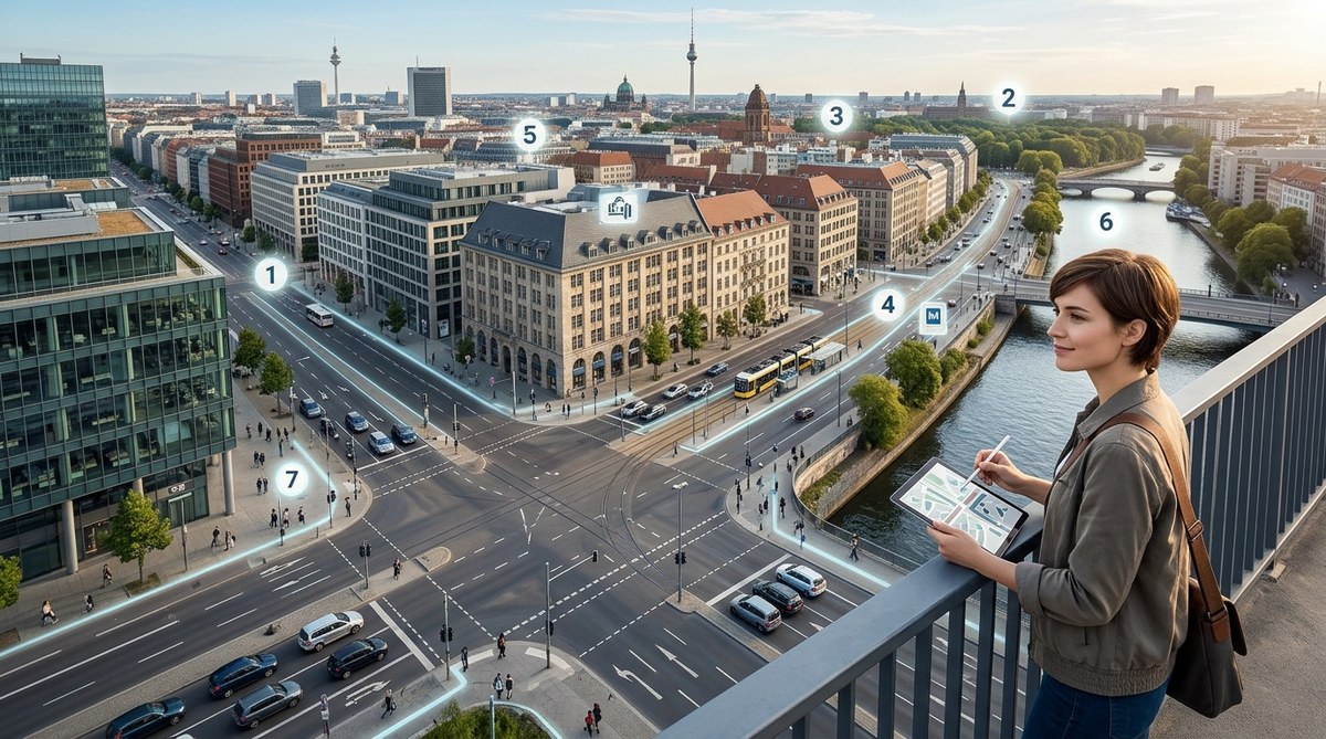
Cities feel chaotic at first. A tangle of streets, a jumble of buildings, and no obvious starting point. But underneath that surface chaos, every city follows a set of hidden rules. These rules are not written on signs or taught in schools. They are embedded in the pavement, the skyline, and the flow of traffic. Once you learn to see them, you stop needing a map. You start reading the city itself.
City layouts follow predictable patterns that anyone can learn. By understanding how grids, landmarks, transit spines, elevation changes, and naming systems work, you can navigate any city without GPS. These unspoken rules of city layouts turn disorientation into direction. Start using them today to feel at home anywhere.
The Grid Is Your Best Friend
Most American cities were built on a grid. Streets run north-south, avenues run east-west, and the numbering makes sense. New York City is the classic example. If you know you are on 42nd Street and need to get to 50th Street, you walk eight blocks north. No calculation needed.
But grids are not all the same. Some cities tilt their grid to follow a river or a coastline. Boston is famous for its cow-path layout, but even Boston has a hidden logic once you find the central artery. The key is to identify the baseline. Find the main street that acts as the zero point. In Manhattan, that is Fifth Avenue. In Washington, D.C., it is North Capitol Street. Once you lock onto that baseline, the rest of the city falls into place.
Not every city uses a perfect grid. Many European cities use a radial pattern where streets branch out from a central square like spokes on a wheel. Paris is a prime example. The Arc de Triomphe sits at the center of a dozen major avenues. If you get lost, find the nearest roundabout or plaza. It will often point you back toward the center.
Water and Elevation Are Natural Compasses
Rivers, lakes, and coastlines are more than just scenic. They are orientation anchors. Most cities grew around a body of water, and that water almost always lies in a consistent direction relative to the city center. In Chicago, Lake Michigan is always east. In San Francisco, the bay is north and east. In Seattle, the Puget Sound is west.
Use water as your constant. If you know the water is to your west, then every time you face the water, you know your orientation. This works even in cities with confusing street patterns. London follows the Thames. Paris follows the Seine. Find the river, and you find your bearings.
Elevation works the same way. Downtown areas are often built on flat land near water. Residential neighborhoods climb the hills. In a city like Pittsburgh, the rivers and hills create natural boundaries. If you are walking uphill, you are likely moving away from the commercial core. If you are walking downhill, you are heading toward the action.
Transit Lines Act as Urban Backbones
Subway lines, bus routes, and light rail tracks are not just for commuting. They are the city’s skeleton. Most transit lines follow major traffic corridors. In New York, the subway lines mirror the avenues. In London, the Tube map is a simplified version of the city’s layout. If you know the name of the line, you know the general direction it travels.
Look for transit stations as landmarks. They are almost always located at important intersections or commercial hubs. If you find a subway entrance, you are likely near a main street. If you find a bus terminal, you are near the city’s transportation core.
A useful trick is to memorize the terminal stations of a city’s main transit line. In Washington, D.C., the Red Line runs from Shady Grove to Glenmont. If you know you are on the Red Line, you know you are traveling roughly east-west. This gives you a directional anchor even underground.
The Skyline Tells You Where You Are
Every city has a distinctive skyline. But more than that, the skyline has a logic. The tallest buildings are usually in the financial district or downtown. Residential towers cluster nearby. Historic landmarks stand out because they are shorter or older.
When you are lost, look up. Find the tallest building or the most recognizable structure. In New York, that might be the Empire State Building. In Chicago, the Willis Tower. In Seattle, the Space Needle. These landmarks act as visual anchors. If you can see them, you can orient yourself relative to the city center.
But do not stop at the obvious landmarks. Look for patterns in building height. In many cities, building height decreases as you move away from the center. If the buildings around you are getting shorter, you are moving outward. If they are getting taller, you are moving inward. This is a simple rule that works in almost every city.
Street Names and Numbering Systems Are Clues
Cities use naming conventions to help you navigate. In Washington, D.C., streets are named alphabetically in one direction and numbered in the other. In Manhattan, streets run east-west and avenues run north-south. In Salt Lake City, the grid is based on a central point with addresses like 200 South and 300 East.
Learn the pattern, and you never need a map. If you know that “Street” means east-west and “Avenue” means north-south, you can navigate any grid city. If you know that addresses increase as you move away from the city center, you can estimate distances.
Some cities use thematic naming. In Paris, arrondissements are numbered in a spiral. In London, postal districts (NW, SE, etc.) give you a rough sense of location. In Tokyo, neighborhoods are numbered by block. Once you understand the system, the city becomes readable.
Pedestrian Flow Reveals the Path of Least Resistance
People naturally follow the easiest route. Wide sidewalks, open plazas, and busy crosswalks are signs of a major pedestrian artery. If you are lost, follow the crowd. Groups of people walking with purpose are usually heading toward transit, shopping, or entertainment districts.
But be careful. Tourist crowds can lead you in circles. Look for locals. Locals walk with a pace and direction that suggests they know where they are going. Follow them, and you will likely end up at a useful destination.
Pay attention to the direction of foot traffic in the morning and evening. In the morning, people flow toward office districts. In the evening, they flow toward residential areas and transit hubs. This daily rhythm is a reliable compass.
Dead Ends and Alleys Have a Purpose
Not every street is meant for through traffic. Dead ends, cul-de-sacs, and alleys are intentional. They slow down traffic, create quiet neighborhoods, or provide service access. If you hit a dead end, do not assume you made a wrong turn. You may have entered a residential pocket.
Alleys are especially useful for navigation in older cities. They often run behind main streets and connect blocks. In cities like Chicago and San Francisco, alleys are part of the original grid design. If you know where the alleys are, you can cut through blocks and save time.
A common mistake is to assume that all streets connect. They do not. Some cities use a system of one-way streets that force you into specific patterns. Learn the one-way system, and you can predict traffic flow. This is especially useful in downtown areas where streets are narrow.
How to Practice These Rules
You do not need to travel to a foreign city to practice. Start in your own hometown. Pick a familiar route and try to navigate it using only these rules. Turn off your GPS. Use the sun, the water, and the street names to find your way.
Here is a simple process to follow:
- Identify the city’s central point. This could be a square, a landmark, or a major intersection.
- Find the nearest body of water or major elevation change. Use it as your directional anchor.
- Locate the main transit line. Note which direction it travels.
- Look at the skyline. Find the tallest building and use it as a reference.
- Read the street signs. Look for a pattern in names or numbers.
- Watch the pedestrian flow. Follow the crowd if you are unsure.
- If you get stuck, find a dead end or alley. Use it to reorient.
Common Mistakes to Avoid
Even experienced navigators make errors. Here are the most common pitfalls and how to avoid them.
| Mistake | Why It Happens | How to Fix It |
|---|---|---|
| Relying only on GPS | Your brain stops building mental maps | Turn off GPS and use landmarks instead |
| Ignoring elevation | Flat cities hide directional clues | Look for subtle slopes or hills |
| Confusing street types | “Street” and “Avenue” mean different things in different cities | Learn the local naming convention first |
| Following tourists | Tourist flow leads to attractions, not always useful destinations | Follow locals with purposeful walks |
| Forgetting the sun | Overcast days hide the sun’s position | Use shadows or building orientation instead |
Expert Advice on Building Your Navigation Instinct
“The best navigators do not memorize every street. They build a mental model of the city’s structure. Once you understand the skeleton, you can fill in the details as you go.” — Ken Hill, urban wayfinding consultant
This is the core idea. You are not trying to memorize a map. You are trying to understand the city’s logic. Every city has one. Some are obvious, like the grid of Manhattan. Others are hidden, like the radial pattern of Paris. But once you find it, you can navigate with confidence.
Putting It All Together in 2026
The world is more connected than ever. You can pull out your phone and get directions anywhere. But there is a deeper satisfaction in knowing where you are without looking at a screen. It builds confidence, reduces stress, and makes travel more fun.
Start small. The next time you walk to a coffee shop, notice the street pattern. Is it a grid? A radial? A maze? Look for the water. Check the skyline. See if you can guess which direction is north. Do this every day, and your brain will start building a mental map automatically.
For more on this topic, check out our guide on mastering urban navigation techniques without using a map. It covers practical exercises to strengthen your spatial awareness.
Your City Is Trying to Help You
Cities are not designed to confuse you. They are designed to move people efficiently. The rules are there. You just have to learn to see them. Once you do, every city becomes familiar. You will never feel lost again.
So the next time you step off a train or walk out of a hotel, take a moment. Look around. Find the grid. Find the water. Find the skyline. And let the city guide you.