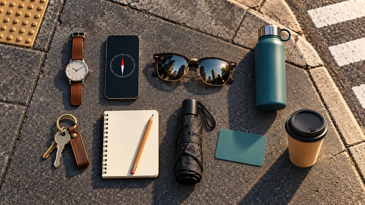
Your phone battery hits 5% on a crowded subway platform. You need to find a coffee shop two blocks over, but the map app is gone. Panic sets in. It doesn’t have to. The truth is, you are surrounded by everyday objects that double as navigation aids. You just need to know how to read them. A wristwatch, a shadow on the sidewalk, even the way a building’s windows catch the afternoon light can tell you exactly where you are.
You already carry powerful navigation tools in your pockets and on your body. This guide shows you how to use everyday objects as navigation aids when your phone dies or the GPS signal drops. Learn to read shadows, use analog watches, and interpret city infrastructure to find your way home without any specialized gear.
Your Wristwatch Is a Compass
Analog watches are one of the most reliable everyday objects navigation aids. If you have a traditional watch with hands, you can find south in the Northern Hemisphere without any other tool.
Point the hour hand at the sun. Halfway between the hour hand and 12 o’clock is north. South is directly opposite. In the Southern Hemisphere, the trick reverses. You point the 12 o’clock mark at the sun instead, and the halfway point gives you north.
Digital watch users are not left out. You can draw a clock face on the ground with a stick, or simply visualize the hands. This technique works because the sun moves across the sky at a predictable rate. It is accurate enough to get you within a few degrees of true direction.
Shadows Tell the Story
The sun is the most consistent navigation tool we have. Every shadow is a compass needle. You can use a stick and a few pebbles to track the sun’s movement.
- Push a straight stick into the ground so it stands upright.
- Mark the tip of its shadow with a small rock.
- Wait 15 to 20 minutes.
- Mark the new position of the shadow tip.
- Draw a straight line between the two marks. This line runs roughly east to west. The first mark is west, the second mark is east.
- Stand with the east mark on your right. You are now facing north.
This method works anywhere the sun shines. It is one of the oldest and most reliable everyday objects navigation aids. No compass required.
Building Signs as Directional Clues
City architecture follows patterns. In most U.S. cities, building numbers increase as you move away from a designated baseline. In Manhattan, numbers go up as you head north from Houston Street. In Chicago, Madison Street is the zero point. Numbers increase north and south from there.
You can read a building number and know your approximate position relative to the city center. This is a form of dead reckoning that uses the city’s own grid as a map. Once you learn a city’s baseline street, every address becomes a navigation aid.
“The city grid is the most underrated navigation tool. Once you know the baseline, every address tells you how far you are from the center. It’s like having a ruler built into the sidewalk.” — John Huth, author of The Lost Art of Finding Our Way
The Coffee Cup Test
You just grabbed a coffee from a street cart. The cup has a lid. You can use it to find north.
Set the cup on a flat surface. Let the liquid settle. The surface of the coffee will be perfectly level. Now tilt the cup slightly. The liquid will slosh toward the lower side. This is not helpful yet.
Instead, use the cup as a makeshift level. Place it on a curb or a bench. The liquid line shows you the true horizontal. If you have a compass app, you can align the cup with the compass to verify your bearing. But the real trick is simpler. Look at the cup’s shadow. The shadow of the cup itself, cast by the sun, tells you the sun’s position. From there, you can estimate east and west.
Street Signs and Pole Markings
City infrastructure is full of hidden navigation data. In many U.S. cities, street signs have small stickers or tags that indicate the block number. A sign reading “2000 W” means you are 20 blocks west of the baseline.
Some cities use color coding on utility poles. In San Francisco, painted lines on utility poles indicate the fire hydrant zone. In older cities like Boston, you can find survey markers embedded in the sidewalk. These brass disks often include latitude and longitude coordinates.
Learning to spot these everyday objects navigation aids turns a routine walk into a data rich experience.
| Object | What It Tells You | Common Mistake |
|---|---|---|
| Wristwatch | Direction (south/north) | Forgetting daylight saving time adjustments |
| Building numbers | Distance from baseline | Assuming numbers increase in the same direction everywhere |
| Utility pole tags | Block number or zone | Ignoring the color coding system |
| Sidewalk survey markers | Exact coordinates | Walking past without looking down |
| Coffee cup shadow | Sun position | Using a cup with a curved bottom |
The Subway Grate Trick
Subway grates are not just for warm air. In many cities, the grates have a pattern. The slats run parallel to the street. If you stand on a grate and look at the direction of the slats, you can determine the street’s orientation.
In New York City, most subway grates run north to south on avenues and east to west on streets. This is not a perfect system, but it gives you a rough orientation. Combine this with the sun’s position, and you can narrow down your direction within a few degrees.
Using Storefront Awnings
Awnings are not just for shade. They are often installed on the south facing side of a building to block the most intense sunlight. In the Northern Hemisphere, the sun is in the southern half of the sky for most of the day. Buildings with awnings on one side are telling you which direction gets the most sun.
If you see a row of awnings all on the same side of the street, that side is likely facing south. This is a reliable clue in cities with consistent building codes, like Portland or Seattle.
The Stick and Pebble Method for Time
You can also estimate the time of day using a stick and the sun. Push a stick into the ground. Mark the shadow tip. Wait until the shadow moves one hand width (about 15 degrees). Each hand width equals roughly one hour of time. This is a crude method, but it works when your phone is dead and you need to know if you have time to walk across town before sunset.
A Simple Process for Using Everyday Objects as Navigation Aids
- Stop and look at the sun. Note its position in the sky.
- Check your watch. If it is analog, use the hour hand trick.
- Look for building numbers. Find the baseline street.
- Scan for utility pole tags or survey markers.
- Use shadows to confirm your direction.
- Combine at least two clues before you move.
What to Avoid
- Do not rely on a single clue. Shadows shift throughout the day. Building numbers can be inconsistent in older neighborhoods.
- Do not assume all cities use the same grid system. Boston and Washington, D.C., have very different layouts.
- Do not forget daylight saving time. Your watch may be off by one hour, which throws off the analog watch compass method.
Putting It All Together in a Real City
Imagine you are in downtown Chicago. Your phone dies. You need to get back to your hotel near the Magnificent Mile.
You look at your watch. It is 2:00 p.m. Central Time. You point the hour hand at the sun. The halfway point between the hour hand and 12 o’clock gives you south. You now know north is behind you.
You look at the building numbers. You are on Michigan Avenue. The numbers are increasing as you walk north. You know the baseline is Madison Street, which is at 0. You are near 800 North. That means you are 8 blocks north of Madison.
You check the shadows. They are pointing northeast, which confirms it is early afternoon. You turn south and walk toward the lower numbers. In 8 blocks, you reach the river. Your hotel is near there.
You used three everyday objects navigation aids: your watch, the building numbers, and the shadows. No GPS. No map. Just your own awareness.
Strengthening Your Navigation Skills
These techniques are not just for emergencies. Practicing them daily builds your spatial awareness. You start to notice patterns in your city that you never saw before. The way the light falls on a certain building. The direction of the wind. The smell of a bakery that tells you the train station is two blocks east.
For more ways to sharpen your senses, read our guide on how to develop your urban senses for seamless city navigation in 2026. You can also learn to read the urban environment to navigate without a map.
Turning Your Commute Into a Navigation Practice Session
You do not need to be lost to practice. Try this on your next commute. Leave your phone in your pocket. Use only the everyday objects around you to confirm your direction. Check your watch against the sun. Look at the building numbers. See if the shadows match your expectations.
Within a week, you will start to see the city as a living map. Every shadow, every sign, every coffee cup becomes a tool. You will never feel lost again.
Your City Is Full of Hidden Guidance
The best navigation tools are already in your hands. Your watch, the sun, the buildings, the street signs. They are all speaking to you. You just need to learn the language. Start small. Use one technique today. Add another tomorrow. Before you know it, you will navigate any city with confidence, no battery required.
For a deeper look at how to build a mental map of any city, check out our guide on how to build a mental map of any city in one week. And if you want to understand why your phone might be hurting your sense of direction, read why your smartphone is ruining your sense of direction.
Now go for a walk. Look down at the sidewalk. Look up at the sky. Notice the small details. They are all navigation aids, waiting for you to use them.