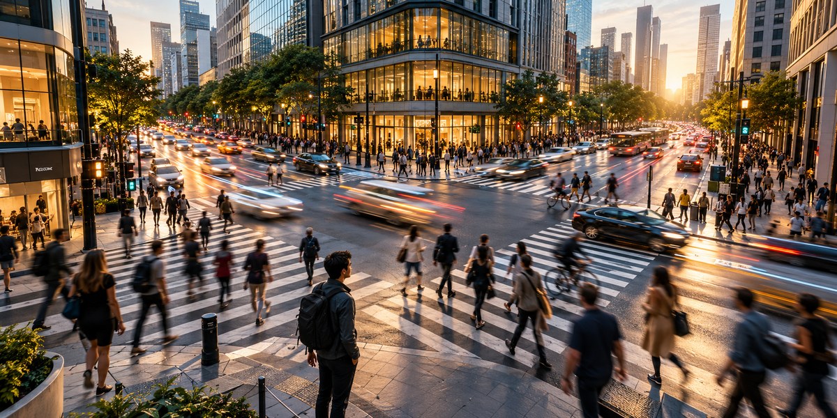
Every city has a rhythm. It pulses through the streets like a heartbeat. You can feel it in the morning rush, the midday lull, and the evening flood of people leaving offices. Learning to read that pulse is one of the most powerful skills for instant orientation. When you understand pedestrian flow analysis for urban orientation, you stop needing a map. The city itself becomes your guide.
Pedestrian flow analysis reveals a city’s functional structure. By watching how people move, where they gather, and how traffic shifts with time, you can identify major transit hubs, commercial corridors, and residential zones. This skill lets you orient yourself in any unfamiliar downtown within minutes. You learn to see the city as a living system, not just a collection of streets.
Why Foot Traffic Reveals a City’s True Layout
Maps show you geometry. Pedestrian flow shows you behavior. A wide boulevard on paper might feel empty in real life. A narrow alley packed with foot traffic tells you something different. It tells you that alley connects two important places.
Cities are designed around movement. The most successful public spaces are the ones that people naturally flow through. When you learn to read that flow, you can predict where the main train station is, where the popular shopping district starts, and where the quiet residential blocks begin. You can do this without a single glance at your phone.
Think about your own city. You probably know which streets feel busy at 8 AM and which ones feel dead at 8 PM. That knowledge is pedestrian flow analysis. You just never gave it a name.
The Science Behind Urban Rhythms
People move in predictable patterns. These patterns are shaped by three main forces:
- Transportation hubs: Train stations, bus terminals, and subway entrances create pulses of foot traffic every time a vehicle arrives.
- Employment centers: Office districts flood with people in the morning and empty out in the evening.
- Commercial and entertainment zones: Restaurants, theaters, and shopping areas attract crowds during lunch hours and evenings.
These forces create what urban planners call “tidal flows.” You can map them just by watching the sidewalk. The direction people walk tells you where the nearest transit stop is. The speed they walk tells you if they are commuting or strolling. The density of the crowd tells you if you are approaching a major intersection or a dead end.
How to Read Pedestrian Flow in Three Steps
You can start using pedestrian flow analysis for urban orientation today. Here is a simple process to follow when you arrive in an unfamiliar area.
-
Find a high point or a wide intersection. Stand somewhere you can see at least two blocks in multiple directions. A corner near a park or a plaza works well. Watch the flow for five minutes. Notice which direction most people are walking. That is your primary traffic axis.
-
Identify the “push” and “pull” factors. Watch for people carrying things. Bags, groceries, briefcases. People carrying bags are usually heading toward a destination. People with empty hands might be returning from one. Follow the people with bags. They will lead you to markets, shops, or transit stations.
-
Check the sidewalk width. Wide sidewalks with lots of foot traffic usually lead to public squares, transit hubs, or major commercial streets. Narrow sidewalks with light traffic lead to residential areas. If you need to find the center of the city, follow the widest sidewalks with the most people.
This method works in almost any American city. Try it in New York, Chicago, or San Francisco. You will notice the same patterns repeating.
Common Mistakes in Reading Urban Flow
Even experienced observers make errors. Here is a table that breaks down common mistakes and the correct approach.
| Mistake | Why It Happens | What to Do Instead |
|---|---|---|
| Confusing commuting flow with destination flow | Morning crowds move toward work, evening crowds move away. Both look similar at first glance. | Note the time of day. Adjust your reading based on whether it is rush hour or midday. |
| Assuming all crowds point to the same place | A crowd leaving a stadium points away from the stadium, not toward it. | Look at the direction people are facing. Faces tell you where they are going. |
| Ignoring vehicle traffic patterns | Cars and buses often follow the same logic as pedestrians. | Watch both foot and vehicle traffic. They usually reinforce each other. |
| Reading flow at the wrong time | A street that is empty at 2 PM might be packed at 6 PM. | Spend at least 15 minutes observing. Better yet, come back at a different hour. |
“The best way to learn a city is to stand still and watch. The city will tell you where it wants you to go.” — William H. Whyte, urbanist
Vehicle Rhythms as a Secondary Compass
Pedestrians are not the only source of data. Vehicle traffic tells a similar story. In most American cities, traffic flows follow the same logic as foot traffic. Major arteries carry the most cars. Residential streets carry the least.
Watch the taxis and ride-share vehicles. They know the fastest routes. If you see a steady stream of cabs turning down a side street, that street is likely a shortcut to a major destination. Follow it.
Bus routes are another clue. Buses stop at places where people gather. If you see multiple bus lines converging at one intersection, that intersection is a transit hub. Stand there and watch which direction people walk after they get off. That will tell you what is nearby.
For a deeper look at using all types of city infrastructure as navigation cues, read our guide on how to use traffic, bus routes, and city infrastructure as navigation cues.
Using Flow Analysis for Urban Planning
If you are an urban planner or architect, pedestrian flow analysis is not just a navigation trick. It is a design tool. You can use it to evaluate how well a public space functions.
A plaza that people walk through quickly is not a successful gathering space. A sidewalk that forces people to slow down or stop creates congestion. By studying flow patterns, you can identify where to add seating, widen paths, or create new crossings.
The same principles apply to wayfinding systems. If you know where people naturally flow, you can place signs, landmarks, and public art in locations where they will be seen. You can design streets that guide people intuitively.
How to Practice This Skill
Like any skill, reading urban flow takes practice. Start with places you already know. Spend ten minutes on a busy corner in your own neighborhood. Notice the patterns. Then try it in a part of town you rarely visit.
Here are a few exercises to build your ability:
- Count the flow: Pick a spot and count how many people walk past in five minutes. Do this at three different times of day. Compare the numbers.
- Map the direction: Draw a simple sketch of the intersection. Draw arrows showing where most people are going. You will see the dominant direction emerge.
- Follow the crowd: Pick a flow and follow it for two blocks. See where it leads. You might discover a coffee shop, a park, or a transit entrance you never noticed.
For more structured practice, check out our article on how to use foot traffic patterns to navigate any city without a map.
The Limits of Flow Analysis
No single method is perfect. Pedestrian flow analysis has limits. It works best in dense, walkable urban areas. In sprawling suburbs or car-dependent cities, foot traffic is sparse. You will need to rely more on vehicle patterns and street geometry.
Weather also affects flow. Rain, extreme heat, or cold will push people indoors. Your readings will be different on a sunny Saturday than on a rainy Tuesday. Account for that.
And of course, special events can distort normal patterns. A parade, a protest, or a street fair will redirect foot traffic in ways that do not reflect the city’s everyday layout. If you see unusual crowds, check the date. You might have stumbled into a local festival.
Putting It All Together
Pedestrian flow analysis for urban orientation is a skill that grows with use. The more you practice, the more you will notice. You will start seeing the city as a living system. You will feel its pulse.
The next time you visit a new city, leave your phone in your pocket for the first fifteen minutes. Find a busy corner. Watch the people. Let them show you the way. You will be surprised how much you can learn just by paying attention.
Your City Is Speaking. Are You Listening?
Every sidewalk tells a story. Every crowd has a destination. Every traffic jam has a logic. You just need to know what to look for.
Start small. Pick one intersection near your home or office. Watch it for ten minutes tomorrow morning. Notice the flow. Notice the rhythm. That is your first step toward reading the city’s pulse.
Once you master this skill, you will never feel lost again. Not because you have a map, but because you understand the language of the streets. And that is a skill no phone can take away from you.
For more ways to strengthen your natural navigation abilities, read our guide on top 7 tips for improving your spatial awareness in any city.