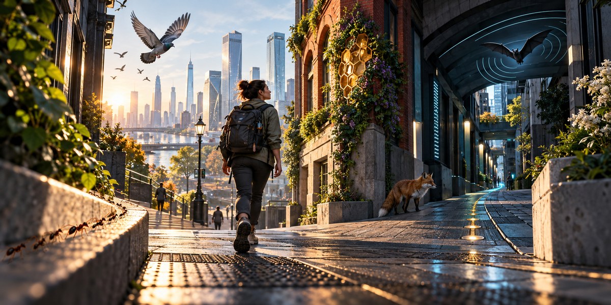
The city is a concrete jungle, but the animals that thrive there have always known how to read it. Pigeons navigate by the sun. Ants leave chemical trails. Dogs follow scent. These aren’t just random facts. They are proven methods of navigation that work without a single bar of signal. In 2026, we have more digital tools than ever, yet our ability to move through a city without them has atrophied. This guide will help you rebuild that instinct. You will learn five animal-inspired urban tracking techniques that let you read any city like a native species.
Urban tracking techniques animal navigation is about using your senses the way animals do. By reading the sun, following scent corridors, recognizing territorial markers, and using sound echolocation, you can build a mental map of any city. These five methods will help you move through urban spaces with confidence, even when your phone is dead.
The Pigeon Method: Sun Compass and Shadow Reading
Pigeons have an internal magnetic compass, but they also rely heavily on the sun. You can do the same. The sun rises in the east and sets in the west. This is basic, but it is the foundation of all natural navigation.
In a city, you rarely see the horizon. But you can read shadows. Here is how to practice the pigeon method:
- Find a straight shadow. Look for a lamppost, a traffic light pole, or the corner of a building.
- Note the time. In the northern hemisphere, a shadow at noon points directly north. In the southern hemisphere, it points south.
- Use the building grid. Many US cities like New York, Chicago, and Phoenix are built on a grid. If you know the sun is behind you in the morning, you are walking west. If it is in your face, you are heading east.
This technique works best between 10 AM and 2 PM when shadows are shortest and most directional. Practice it on your next commute. Pick a landmark and guess which direction it is. Then check your guess against a physical compass or the sun’s position. Over time, you will build an internal compass that does not need a battery.
“The sun is the most reliable navigational tool we have. It never needs a signal, and it never lies.” – Tristan Gooley, author of The Natural Navigator
The Ant Method: Scent Corridors and Olfactory Landmarks
Ants leave pheromone trails to guide their colony to food. Cities have their own scent corridors. You just need to learn how to read them.
Start by noticing the smell of different neighborhoods. A bakery on a side street creates a scent plume that travels down the block. A coffee roaster marks a corner. A subway grate releases a mix of warm air, metal, and diesel fumes. These are your urban pheromones.
To use the ant method for urban tracking techniques animal navigation, follow these steps:
- Create a scent map. As you walk a new route, mentally note three distinct smells. For example, “the corner of 5th and Main smells like fresh bread,” and “the alley behind the theater smells like wet concrete and garbage.”
- Follow the trail. If you need to find a specific cafe, you might not remember the street name, but you might remember that it is “two blocks past the pizza place that smells like garlic and oregano.”
- Use negative scent. A sudden lack of smell can also be a cue. If you walk out of a food district into a residential area, the shift in air quality is a clear boundary marker.
This method is especially useful in older US cities like Boston or Philadelphia where the street grid is chaotic. Your nose can guide you when the map fails.
The Wolf Method: Territorial Markers and Graffiti Language
Wolves mark their territory with urine and scratches. Humans do the same, but we use paint, signs, and architecture. Territorial markers are all around you. You just need to learn to read them.
Graffiti is a prime example. In many cities, different crews mark their territory with specific tags. If you see the same tag repeated every few blocks, you are walking through a crew’s turf. This is not just for gang identification. It can also be a directional cue. A tag that points left or right can indicate a path.
Other territorial markers include:
- Street furniture. Benches, bus stops, and mailboxes are placed in predictable patterns. In most US cities, fire hydrants are spaced at regular intervals. If you know the pattern, you can estimate distance.
- Utility markings. Spray-painted lines on sidewalks indicate underground pipes and cables. The colors follow a national standard. Red means electrical. Yellow means gas. Blue means water. Following a blue line can lead you to a water main, which often runs under major streets.
- Storefront evolution. The oldest buildings in a city block usually have the most signage layers. Peeling paint on a brick wall shows decades of business names. This is a timeline of the neighborhood.
For a deeper understanding of how to read these cues, check out this guide on mastering urban wayfinding techniques for confident city navigation in 2026.
The Bat Method: Echolocation and Sound Mapping
Bats use sound to see in the dark. You can do the same in a noisy city. Sound reflects off surfaces. A wide street with tall buildings creates an echo. A narrow alley absorbs sound. You can use this to build a mental map.
Here is a table comparing common sound cues and what they tell you:
| Sound Cue | What It Reveals |
|---|---|
| Traffic noise fading | You are moving away from a major road |
| Footsteps echoing | You are in a tunnel, alley, or under a bridge |
| Train rumble vibrating up through your feet | You are near a subway line or rail track |
| Sudden silence | You have entered a dead-end or a courtyard |
| Birdsong volume increasing | You are near a park or green space |
To practice the bat method, close your eyes for ten seconds while standing on a busy corner. Listen to the layers of sound. The closest sound is the car passing. The next layer is the bus two blocks away. The farthest layer is the highway hum. This gives you a sense of depth and distance.
Use this technique when you are underground or in a subway station. The sound of the train moving through the tunnel can tell you which direction it is heading. A rising pitch means it is moving toward you. A falling pitch means it is moving away.
The Salmon Method: Water Flow and Drainage Patterns
Salmon swim upstream to return to their birthplace. Water is a powerful natural guide. Most US cities are built along rivers, lakes, or coastlines. The water dictates the layout.
Start by finding the nearest body of water. In a city like Chicago, the Chicago River divides the city into three main branches. If you know which branch you are on, you can orient yourself to Lake Michigan.
If there is no visible water, look for drainage. Rainwater flows downhill. Streets are designed to slope toward drains. If you follow the slope of a sidewalk, you will eventually hit a main road or a sewer line.
- Look for grates. Storm drains are usually placed at low points. If you see a line of grates, you are walking along a valley.
- Check the curb. The curb height changes with the slope. A lower curb means water is pooling there.
- Follow the green. Trees and plants grow thicker where water collects. A line of lush trees in a desert city like Phoenix or Las Vegas indicates an underground water source or an irrigation canal.
This method works best in older cities like San Francisco or Seattle where the natural topography has not been completely flattened. It is a direct link to the landscape that existed before the buildings.
Common Mistakes in Urban Animal Navigation
Even experienced urban trackers make errors. Here are the most common pitfalls and how to avoid them.
| Mistake | Why It Happens | How to Fix It |
|---|---|---|
| Relying only on the sun | Clouds, tall buildings, and tunnels block the sun. | Always have a backup method. Use sound or scent as a secondary check. |
| Ignoring seasonal changes | The sun’s path shifts throughout the year. | Learn the solstice and equinox positions. In summer, the sun is higher. In winter, it is lower. |
| Confusing similar smells | A bakery and a pizzeria both smell like bread. | Add a visual landmark to the scent. “The bakery on the corner with the red awning” is better than just “the bakery.” |
| Over-relying on graffiti | Tags can be painted over or changed by rival crews. | Use graffiti as a secondary cue. Always confirm with another method. |
| Forgetting about wind | Wind carries scent and sound away from you. | Face into the wind to catch smells. Face away from the wind to hear better. |
How to Build Your Own Urban Tracking Routine
You do not need to master all five methods at once. Start with one. Pick the pigeon method for a week. Every time you step outside, notice the sun and the shadows. Guess the cardinal directions. Check yourself.
After a week, add the ant method. Notice one distinct smell on your commute. The following week, add the wolf method. Look for territorial markers. Over a month, you will build a full sensory toolkit.
For more structured practice, read this guide on how to develop your urban senses for seamless city navigation in 2026. It includes daily exercises that take less than five minutes.
Putting the Senses Together in a Real Scenario
Let us say you are in downtown Austin, Texas. Your phone dies. You need to get back to your hotel near the river.
First, use the pigeon method. It is 2 PM. The sun is slightly west. You know the river is south. You walk with the sun on your left shoulder. That keeps you heading south.
Second, use the ant method. You catch a smell of barbecue. You remember your hotel is two blocks from a famous BBQ joint. You follow the smell.
Third, use the wolf method. You see a series of blue utility lines painted on the sidewalk. They run parallel to the main road. You follow them.
Fourth, use the bat method. You hear the sound of a bridge. The river is ahead.
Fifth, use the salmon method. You feel the ground slope downward. You are heading toward the water.
You have arrived at the river. Your hotel is in sight. You did not use a single app.
Reclaiming Your Natural Navigation Instincts
The ability to move through a city without a digital crutch is not a parlor trick. It is a survival skill. In 2026, we are surrounded by technology that tells us exactly where to go. But that technology can fail. Batteries die. Signals drop. Maps become outdated.
Animals do not have that problem. They use their senses. They read the environment. They adapt.
You can too. Start today. On your way home, put your phone in your pocket. Use one of these five methods. Notice the sun. Smell the air. Listen to the city. Read the walls. Feel the ground. Your brain is wired for this. You just need to wake it up.
If you want to go deeper, this article on how to train your brain for better urban spatial awareness offers a seven-day plan to sharpen your skills. The city is your teacher. All you have to do is pay attention.