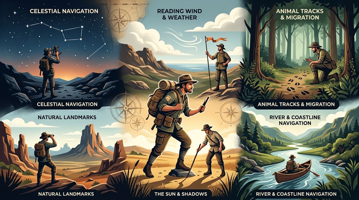
Before GPS lived in our pockets, people found their way across continents using nothing but their wits and the world around them. They crossed oceans, mapped uncharted territories, and navigated dense forests without a single satellite overhead. These pre smartphone wayfinding techniques were not just about survival. They were about understanding the land in a deep, intuitive way. Today, we can still learn from them.
Pre smartphone wayfinding techniques relied on observation, memory, and natural cues. Explorers used the sun, stars, wind patterns, and landmarks to travel vast distances. These skills built spatial awareness and confidence. Modern navigators can revive these methods to sharpen their instincts, reduce phone dependency, and navigate any environment with greater ease and certainty.
Reading the Land Like a Map
Before paper maps became common, explorers read the terrain itself. Every hill, river, and tree line told a story. This skill, called terrain association, is one of the most powerful pre smartphone wayfinding techniques.
The process is simple but takes practice. Here is how you can start training your eye today:
- Look for the big shapes first. Identify major landforms like ridges, valleys, and mountain ranges. These act as your primary reference points.
- Notice the water flow. Rivers and streams always flow downhill. In most of the United States, they eventually lead to larger bodies of water. If you are lost, following a stream downstream will often bring you to civilization.
- Check the vegetation. Dense moss on tree bark usually indicates north in the northern hemisphere, but it is not always reliable. A better clue is the growth pattern of trees. On exposed slopes, trees often lean away from the prevailing wind.
- Use the sky as a guide. Bird migration paths, cloud movement, and the position of the sun all offer directional clues.
- Build a mental checklist. Every time you step outside, note three major land features around you. Over time, this becomes automatic.
- Practice without a phone. Go to a local park and try to describe your location using only the natural features you see.
“The land does not hide its secrets. It only waits for someone patient enough to read them.” — John R. Stilgoe, landscape historian
The Sun and Shadows as Your Compass
Before the compass became standard gear, travelers used the sun. This is one of the oldest pre smartphone wayfinding techniques, and it works anywhere in the world.
In the northern hemisphere, the sun rises in the east and sets in the west. At noon, it sits due south. But you can get even more precise using a shadow stick.
Here is a bulleted breakdown of how to do it:
- Plant a straight stick upright in flat ground.
- Mark the tip of its shadow with a small stone.
- Wait 15 to 20 minutes.
- Mark the new position of the shadow tip.
- Draw a straight line between the two stones. This line runs east to west. The first mark is the west end, and the second mark is the east end.
- Stand with the west mark on your left and the east on your right. You are now facing north.
This technique works every time the sun is visible. It requires no tools, no batteries, and no signal. For anyone interested in mastering urban navigation techniques without using a map, the shadow stick method is a fantastic starting point.
Stars and the Night Sky
When the sun goes down, the stars take over. For centuries, Polynesian voyagers navigated thousands of miles of open ocean using only the stars. They memorized the rising and setting points of specific stars and used them as guides.
The North Star, Polaris, is the most famous celestial marker in the northern hemisphere. It sits almost directly above the North Pole. To find it, locate the Big Dipper. The two stars at the end of its cup point directly to Polaris.
But you do not need to be a sailor to use this. Here is a simple table comparing common celestial navigation mistakes and how to avoid them:
| Common Mistake | Why It Happens | The Fix |
|---|---|---|
| Confusing Polaris with other bright stars | Many bright stars look similar near the horizon | Use the Big Dipper as your starting point every time |
| Assuming stars are stationary | Stars move across the sky due to Earth’s rotation | Track a star’s position over 10 minutes to see its arc |
| Forgetting seasonal star changes | Different constellations are visible in different seasons | Learn 3 or 4 seasonal constellations per year |
| Relying on a single star | Clouds or haze can hide your guide | Memorize at least two backup stars or constellations |
Practicing with the night sky builds a skill that works even when your phone dies. It is one of the most reliable top tips for developing natural wayfinding skills in urban environments, especially on clear nights in city parks.
Wind, Snow, and Sand Patterns
Not all pre smartphone wayfinding techniques rely on vision. Explorers in deserts, arctic regions, and open plains learned to read the wind.
Wind shapes the environment in predictable ways. In sandy deserts, dunes form with a gentle slope on the windward side and a steep slope on the leeward side. In snowy regions, snowdrifts pile up on the downwind side of rocks and trees. These patterns tell you which direction the prevailing wind comes from.
If you know the regional wind patterns, you can use them as a compass. For example, the trade winds in the Atlantic blow from east to west. Sailors relied on this for centuries. In the American Great Plains, the wind usually blows from the west. A hiker who knows this can use the direction of bent trees or drifting snow to stay oriented.
This technique is especially useful for anyone learning to master urban navigation without maps using these essential skills. Even in a city, you can watch how dust, leaves, and trash move to determine wind direction.
Memory and Mental Maps
Before smartphones, people carried maps in their heads. They built mental models of their surroundings by walking, observing, and repeating routes. This is called cognitive mapping.
Explorers like Daniel Boone and Sacagawea did not carry detailed charts. They memorized river bends, mountain passes, and distinctive rock formations. They could describe a route they had walked once, years later, with startling accuracy.
You can train your own mental mapping skills today. Here are three practical exercises:
- The blind walk. Walk a new route while paying close attention. Then try to walk it back with your eyes closed, using only your memory of the turns and distances.
- The sketch challenge. After visiting a new neighborhood, draw a map of it from memory. Include streets, landmarks, and the direction of the sun.
- The verbal route. Describe a route to a friend without using street names. Use only landmarks, turns, and distances.
These exercises rebuild the neural pathways that smartphones have weakened. For those who want to go further, learning how to read the urban environment to navigate without a map in 2026 can turn any city into a familiar landscape.
Animal Behavior and Natural Signs
Animals have been navigating for millions of years. Early explorers watched them for clues.
Birds are especially useful. Migrating birds fly in predictable directions during spring and fall. Honeybees always return to their hive in a straight line. In coastal areas, seabirds fly toward land in the evening and out to sea in the morning.
Other animals leave subtle signs. Squirrels and rabbits build their nests on the sheltered side of trees, often facing south or east in North America. Spider webs are usually built on the south or southeast side of bushes, where the morning sun warms them first.
Even the direction of ant hills can help. In many regions, ants build their mounds with a gentle slope on the south side to catch the sun. These small clues add up.
If you want to develop your urban navigation skills using sound and scent cues, start by paying attention to the animals around you. City parks, greenways, and even your own backyard are full of navigational information.
Putting It All Together in 2026
We live in a world where a blue dot on a screen tells us exactly where to go. That is convenient, but it comes at a cost. Our natural wayfinding instincts have dulled. We no longer notice the position of the sun, the shape of the land, or the behavior of animals.
The good news is that these skills are not gone. They are just dormant. You can wake them up again with a little practice.
Start small. Next time you walk to the store, leave your phone in your pocket. Notice which direction you are walking. Look for the sun. Find a landmark and remember it. Over time, these small acts will rebuild your internal compass.
For history enthusiasts, these techniques connect you to the explorers who came before. For outdoor adventurers, they provide a backup when technology fails. For UX and wayfinding designers, they offer timeless principles of spatial thinking.
The world is still full of clues. You just have to look up from the screen to see them.
Reviving the Lost Art of Natural Navigation
The best navigators in history did not have satellites. They had attention, patience, and a deep respect for the world around them. They knew that every shadow, every star, and every gust of wind carried information.
You can learn to read those signals too. It does not require a course or a special kit. It just requires you to slow down and pay attention.
Start with one technique. Practice it for a week. Then add another. Before you know it, you will be navigating with the same confidence as the explorers of old. And when your phone battery dies or you find yourself in a place with no signal, you will know exactly what to do.