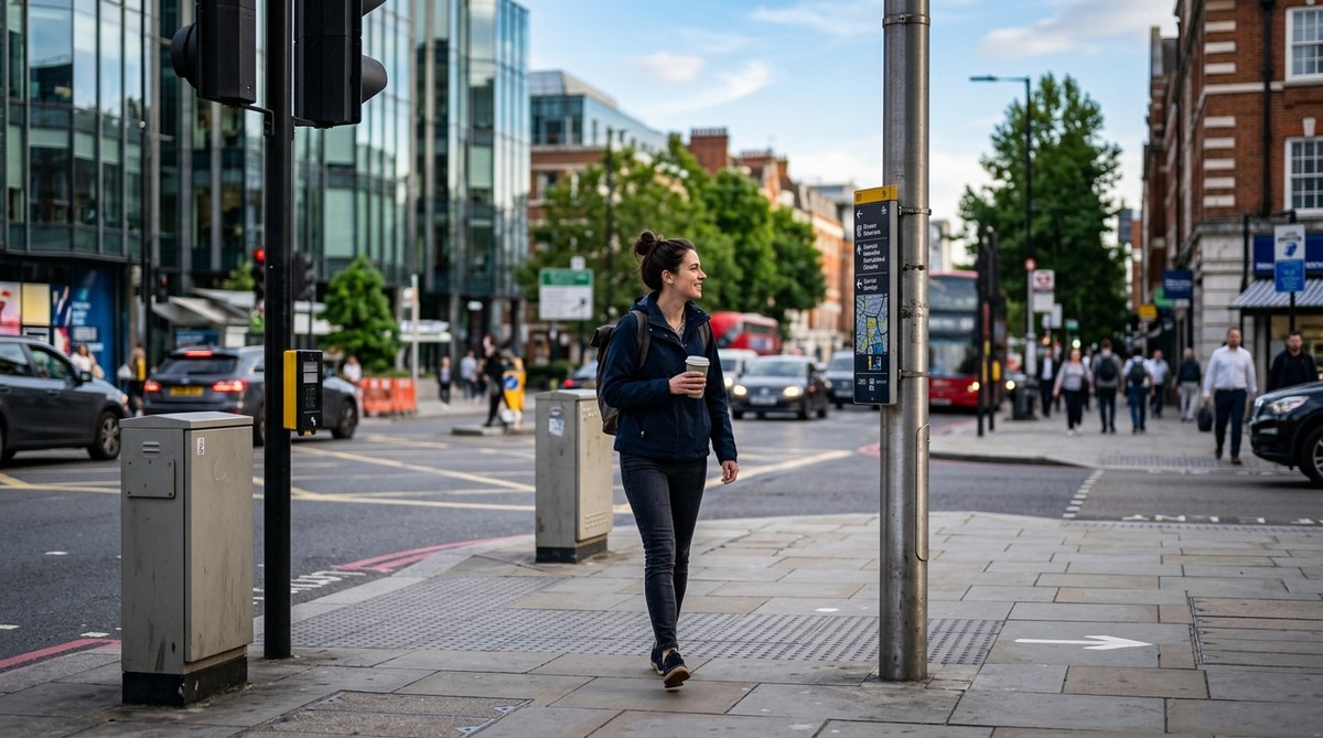
The city is talking to you. You just need to know where to look.
Every bench, signpost, bollard, and trash can was placed in a specific spot for a reason. City planners, traffic engineers, and urban designers leave behind a trail of clues. They use street furniture as a silent language. Once you learn to read it, you can predict your next turn, find a train station, or orient yourself in a neighborhood you have never visited before. This is not about magic. It is about paying attention to the built environment.
Street furniture like bollards, benches, and signs are designed with purpose. Learning to read their shapes, colors, and placements lets you navigate cities without a phone. This guide shows you how to spot a bus stop from a block away, find the direction of a subway entrance, and orient yourself using nothing but the objects on the sidewalk.
What Exactly Is Street Furniture?
Street furniture is the collective name for the objects placed on public sidewalks and roads. Think of it as the furniture of the city. It includes benches, bus shelters, trash receptacles, bollards, street signs, traffic lights, mailboxes, fire hydrants, newsstands, and planters. These items are not random. They follow strict design guidelines set by municipal transportation departments.
In the United States, many cities follow the Manual on Uniform Traffic Control Devices (MUTCD). This federal document dictates the shape, color, and placement of signs and signals. Other objects, like bollards and benches, follow local zoning laws. The result is a consistent visual language. Once you learn the grammar of this language, you can read any American city.
How to Scan for Directional Clues
Before you start memorizing specific objects, train your eyes to scan the environment. Most people look at their phone when they feel lost. Instead, look up and look down. The most useful information is often at eye level or on the ground.
- Look at the tops of poles. Many street signs have small arrows or colored bands that indicate a major street direction.
- Check the sidewalk for tactile paving. Those yellow or red bumpy tiles at crosswalks warn you of a curb. They also mark the edge of a transit platform.
- Notice the color of trash cans and benches. In some cities, these items are color-coded by district or neighborhood. A blue bench might mean you are in a historic district. A green one might signal a park zone.
- Scan for bollards. These short, sturdy posts are often placed to block cars from pedestrian areas. Their shape can tell you if you are near a school, a plaza, or a transit hub.
A Practical Process for Reading Street Furniture
Follow this numbered process the next time you step out the door. It will turn a confusing intersection into a clear set of directions.
- Find a signpost. Start at any corner. Look for the green street sign. It will tell you the name of the street you are on and the cross street. Note the font and color. White lettering on green indicates a standard street. White on blue indicates a highway or interstate route.
- Check the pole for a secondary sign. Many poles have a small white sign with a number or a letter. This is often the block number or the district code. In cities like Washington, D.C., these numbers help you find a specific address.
- Look for a directional arrow on the ground. Some cities paint arrows on the sidewalk pointing toward the nearest subway or bus stop. Others embed small metal arrows in the concrete. These are common near major transit stations.
- Identify the nearest bus shelter. A bus shelter is a goldmine of information. The route map is usually posted inside. But even without reading the map, the shelter itself tells you something. If it has a digital screen, you are likely on a high-ridership route. If it is a simple metal frame, you are on a local line.
- Spot the bollards. Are they short and metal? You are near a standard pedestrian zone. Are they tall and painted white? You might be near a school zone. Are they removable? That area is used for temporary events or farmer’s markets.
Common Mistakes When Decoding Street Furniture
Even experienced urban explorers make errors. Here is a table that shows what beginners often get wrong and how to fix it.
| Mistake | Why It Happens | The Fix |
|---|---|---|
| Confusing a bus shelter with a tram stop | Both have similar roofs and benches. | Look for tracks on the road. Trams run on rails. Buses do not. |
| Misreading a directional arrow on a sign | The arrow points to the next street, not the direction of travel. | Read the sign carefully. If it says “Main St ->” the arrow points to where Main Street is, not where you should walk. |
| Assuming all green signs are street names | Green signs can also indicate highway exits or tourist information. | Check for a white border. Standard street signs have a white border. Tourist signs have a brown background. |
| Ignoring tactile paving | You think it is just a design choice. | Those bumps are a warning. They mean a curb, a platform edge, or a crosswalk is ahead. |
| Thinking a fire hydrant is just for fire trucks | The color of the hydrant cap indicates water pressure. | This is less useful for navigation, but it can tell you something about the age of the neighborhood. Older areas often have lower pressure. |
Expert Advice: “Most people walk through a city looking only at the storefronts. But the real navigation cues are at your feet and above your head. The best way to learn street furniture is to pick one object, like a bollard, and notice every single one on your walk. After a week, you will start to see patterns you never noticed before.” – Jane Jacobs, urban design researcher (paraphrased from The Death and Life of Great American Cities).
Reading Street Furniture in Different U.S. Cities
The language of street furniture changes slightly from coast to coast. Here is a quick guide to three major city types.
New York City
New York uses a distinct system for its subway entrances. Look for a green globe on a lamppost. A green globe means the entrance is open 24 hours. A red globe means it is only open during certain hours. The subway sign itself is a white “M” on a black background. Also, pay attention to the street numbers. In Manhattan, street numbers increase as you go north. Odd numbers are on the north side of the street. Even numbers are on the south side.
San Francisco
San Francisco has a unique system for its hills. The street signs are often mounted on poles that are angled to match the grade of the hill. If you see a sign that is tilted, you are on a steep slope. The city also uses painted curbs to indicate parking rules. A red curb means no parking. A white curb means loading zone. A green curb means short-term parking. These curbs are a form of street furniture that tells you the flow of traffic and the rules of the road.
Chicago
Chicago is famous for its grid system. The street signs are large and easy to read. But the real clue is the address system. The city is divided into quadrants: North, South, East, and West. The zero point is the intersection of State Street and Madison Street. If you see a sign that says “North Clark Street,” you know you are north of Madison. The bollards in Chicago are also distinctive. Many are made of heavy cast iron and are painted black. They are designed to withstand the harsh winters.
How to Train Your Eye in One Week
You do not need a formal class. You just need a week of focused practice.
Day 1: Focus only on bollards. Count every one you see. Notice their material (metal, concrete, plastic). Notice their color. Ask yourself: why is this bollard here?
Day 2: Focus on signs. Look for the green street signs. Notice the font. Is it a standard font like Highway Gothic? Or is it a custom font for a historic district?
Day 3: Focus on benches. Are they public or private? A public bench is usually plain metal or wood. A private bench might have an advertisement on the back.
Day 4: Focus on trash cans. Are they uniform? In some cities, the trash cans are all the same color. In others, they vary by neighborhood.
Day 5: Focus on bus shelters. Look at the route map. Even if you are not taking the bus, the map shows you the major streets of the area.
Day 6: Focus on fire hydrants. Notice the color of the top. This is a small detail, but it connects you to the infrastructure of the city.
Day 7: Combine everything. Walk a familiar route and try to navigate using only street furniture. Do not look at your phone.
The Future of Street Furniture
In 2026, street furniture is becoming smarter. Many cities are installing “smart bollards” that can detect air quality or count pedestrians. Bus shelters now have USB charging ports and real-time arrival screens. Some cities are experimenting with interactive signs that you can scan with your phone to get information. But the basic principles remain the same. The shape, color, and placement of these objects still tell a story.
For more on how to use environmental cues, read our guide on how to read the urban environment to navigate without a map in 2026. If you want to build a mental map of any city, check out how to build a mental map of any city in one week.
Your Next Walk Will Be Different
The next time you step outside, try it. Look at the bollard at the corner. Notice the color of the bench. Read the small print on the signpost. You will start to see the hidden language of the city. It is a skill that makes every walk more interesting and every trip less stressful. You will never feel lost again. You will just feel like you are reading a book, and the book is the street.
Start with one object. Look at the bollard. Ask yourself what it is telling you. Then move to the next object. Over time, the whole city will open up to you. Happy navigating.